Client
Net Check is a part of NC Group. The company specialise in Quality Assurance for modern communication networks. Net Check provides tailored services and solutions such as Mobile and landline network optimisation, benchmarking, CDR reporting and error classification and data collection based on cloud infrastructure with the use of Machine Learning.
Challenge
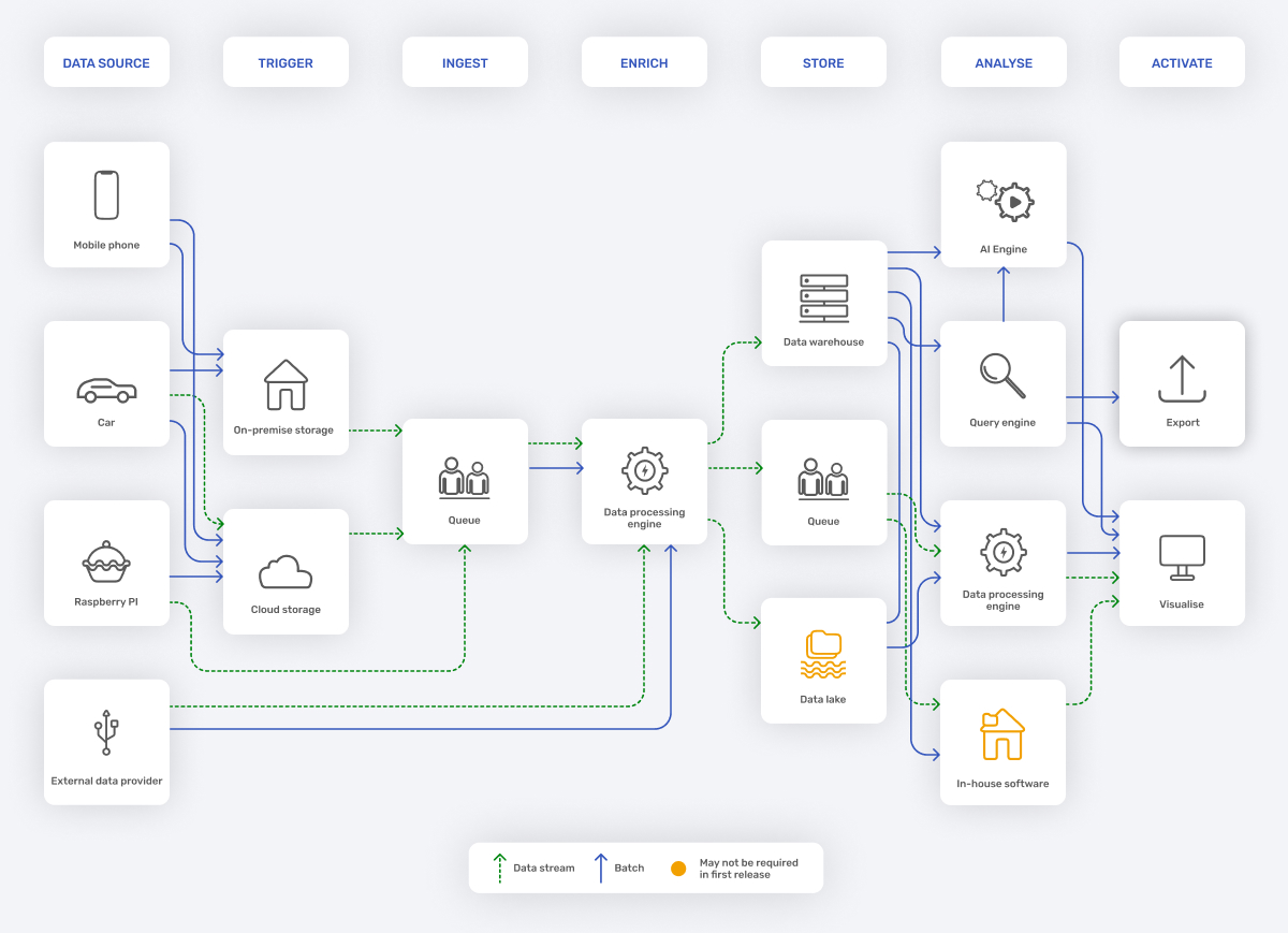
Building a new cloud-based solution that can smoothly integrate with the existing data set and data sources. Report generation should take place in real-time or close to it. The second challenge was to prepare the infrastructure for the subsequent growth of the geospatial data, which had to be visualised. The expected data growth is hundreds of gigabytes per day.
The products were successfully delivered and met 100% of the client’s expectations. Stepwise managed the project well and provided a clear escalation path for the company. They leveraged their expertise to deliver great products. Their expertise, professionalism, and on-time delivery were impressive.
Head of Engineering, Net Check
Services
Consulting
Software Development
Cloud Consulting
Technologies


Scope
The solution was based on the fact that Stewpise wanted to build a platform that, with the help of Dataflow, would process data from different customer sources in parallel. The next step was to process this data. We used Big Query for this. Then, based on BigQuery, we created a geospatial data visualisation using BigQuery Geo Viz.

Results (end customer)
We have proven that by using BigQuery and Dataflow, it is possible to almost completely reduce the cost of maintaining the infrastructure and ensure that it scales with data growth. This allows the customer to focus on data analysis instead of data maintenance. Furthermore, with BigQuery and Geo Viz, we have proven that data analysis, report generation and visualisation is possible in under 1 min.
- Increased performance compared to existing solution
- Easy performance scaling
- Strong support for both Google Services and External Services
- Native support of Geospatial types that allow to optimise complex queries
- Storing historical data is cheaper and easier